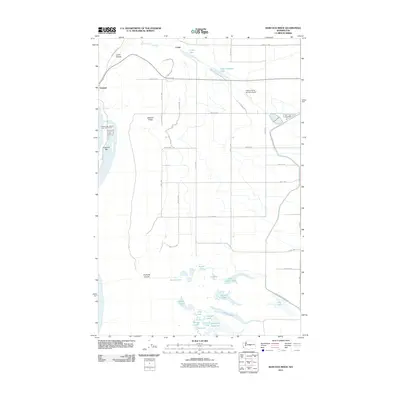
2011 Map of Babcock Ridge
USGS Topo · Published 2011About this map
Babcock Ridge stands as a prominent elevation overlooking a complex landscape of glacial coulees and modern irrigation infrastructure in central Washington. This 2011 survey captures the area as a blend of recreation and agricultural utility, where the Columbia River’s edge at Crescent Bar features the Crescent Bar Resort and Golf Course alongside the small settlement of Trinidad. To the south, the dramatic basalt recession of Potholes Coulee contains a series of water bodies including Ancient Lake and Judith Pool. The eastern portion of the quadrangle is defined by a rigid grid of roads, such as Road 11 NW and Road S NW, supporting the regional aviation at Quincy Flying Service Airport and water management at Evergreen Reservoir. The map illustrates how the natural coulee systems have been integrated into the modern basin through reservoirs like Stan Coffin Lake and Burke Lake.
Find a feature on this map
43 named features on this map. Tap any name to fly to it.
Don’t see what you’re looking for? This feature index may not catch every label — zoom into the map to look around manually.
Map Details
Editions of this 2011 Babcock Ridge Map
This is the sole edition of this map. No revisions or reprints were ever made.
Other maps of this area

1909 · Quincy
USGS Topo · 1:62,500

1910 · Quincy
USGS Topo · 1:62,500

1912 · Malaga
USGS Topo · 1:48,000

1914 · Malaga
USGS Topo · 1:62,500

1920 · Colockum Pass
USGS Topo · 1:125,000

1922 · Colockum Pass
USGS Topo · 1:125,000

1953 · Ritzville
USGS Topo · 1:250,000

1957 · Wenatchee
USGS Topo · 1:250,000

1959 · Ritzville
USGS Topo · 1:250,000

1965 · Ritzville
USGS Topo · 1:250,000