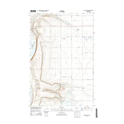
2014 Map of Babcock Ridge
USGS Topo · Published 2014About this map
Babcock Ridge dominates the central landscape of this territory above the Columbia River, showcasing a complex system of basalt coulees and localized depressions. The dramatic topography of Potholes Coulee and Crater Coulee reveals the region's unique geologic character, where numerous small water bodies like Ancient Lake, Dusty Lake, and Judith Pool are scattered across the floor of these erosional features.
Find a feature on this map
47 named features on this map. Tap any name to fly to it.
Don’t see what you’re looking for? This feature index may not catch every label — zoom into the map to look around manually.
Map Details
Editions of this 2014 Babcock Ridge Map
This is the sole edition of this map. No revisions or reprints were ever made.
Other maps of this area

1909 · Quincy
USGS Topo · 1:62,500

1910 · Quincy
USGS Topo · 1:62,500

1912 · Malaga
USGS Topo · 1:48,000

1914 · Malaga
USGS Topo · 1:62,500

1920 · Colockum Pass
USGS Topo · 1:125,000

1922 · Colockum Pass
USGS Topo · 1:125,000

1953 · Ritzville
USGS Topo · 1:250,000

1957 · Wenatchee
USGS Topo · 1:250,000

1959 · Ritzville
USGS Topo · 1:250,000

1965 · Ritzville
USGS Topo · 1:250,000