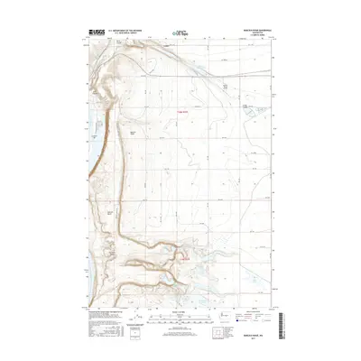
2017 Map of Babcock Ridge
USGS Topo · Published 2017About this map
The Columbia River carves a deep path along the western edge of this central Washington landscape, defining the dramatic topography where the high basalt plateau of Babcock Ridge drops toward the water. At the base of these cliffs, the recreational settlement of Crescent Bar occupies a distinct river terrace, while the surrounding terrain is marked by the unique geomorphology of the Potholes Coulee. This area is characterized by a complex network of small water bodies and catchments, including the Evergreen Reservoir, Quincy Lake, and the interestingly named Judith Pool. The eastern flats show a transition to managed land use with the presence of the Quincy Flying Service. The map traces the intricate drainage patterns of the region, from the deep cuts of Lynch Coulee to the scattered basins of Ancient Lake and Dusty Lake, reflecting the legacy of prehistoric flood events that shaped this part of Grant County.
Find a feature on this map
44 named features on this map. Tap any name to fly to it.
Don’t see what you’re looking for? This feature index may not catch every label — zoom into the map to look around manually.
Map Details
Editions of this 2017 Babcock Ridge Map
This is the sole edition of this map. No revisions or reprints were ever made.
Other maps of this area

1909 · Quincy
USGS Topo · 1:62,500

1910 · Quincy
USGS Topo · 1:62,500

1912 · Malaga
USGS Topo · 1:48,000

1914 · Malaga
USGS Topo · 1:62,500

1920 · Colockum Pass
USGS Topo · 1:125,000

1922 · Colockum Pass
USGS Topo · 1:125,000

1953 · Ritzville
USGS Topo · 1:250,000

1957 · Wenatchee
USGS Topo · 1:250,000

1959 · Ritzville
USGS Topo · 1:250,000

1965 · Ritzville
USGS Topo · 1:250,000