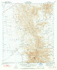
1941 Map of Baboquivari Peak
USGS Topo · Published 1967About this map
The Papago Indian Reservation dominates this 1941 landscape, centered on the dramatic profile of Baboquivari Peak and the high ridges of the Quinlan Mountains. Life in this arid Pima County expanse is traced through isolated settlements and cattle operations, from the administrative center at Sells to family-named outposts like Otero Ranch and Perkins Ranch. The map captures a moment when traditional land use intersected with early industrial and educational infrastructure, evidenced by the Allison Mine and the Fresnal Canyon Sch tucked into the canyons.
Find a feature on this map
53 named features on this map. Tap any name to fly to it.
Don’t see what you’re looking for? This feature index may not catch every label — zoom into the map to look around manually.
Map Details
Editions of this 1941 Baboquivari Peak Map
3 editions found
Other maps of this area

1920 · Arivaca
USGS Topo · 1:125,000

1934 · Tucson Mountains
USGS Topo · 1:125,000

1934 · Silver Bell
USGS Topo · 1:125,000

1937 · Comobabi
USGS Topo · 1:48,000

1938 · San Vicente
USGS Topo · 1:62,500

1940 · Palo Alto Ranch
USGS Topo · 1:62,500

1941 · Presumido Peak
USGS Topo · 1:62,500

1941 · San Vicente
USGS Topo · 1:62,500

1941 · Cocoraque Butte
USGS Topo · 1:62,500

1941 · Baboquivari Peak
USGS Topo · 1:62,500