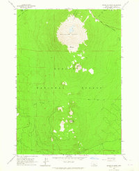
1963 Map of Bachelor Butte
USGS Topo · Published 1965About this map
Bachelor Butte dominates this mid-century topographic survey of the central Oregon Cascades, showing the peak before its later name change. The landscape is defined by volcanic features and the heavy timber of the Deschutes National Forest. High-elevation lakes including Sparks Lake and Hosmer Lake sit on the western edge of the quadrangle, while the east is marked by the course of Dutchman Creek. Transportation through the area is limited to the Cascade Lakes Highway and a network of primitive routes such as the Edison Ice Cave Trail and various unnamed Jeep Trails. To the south, Sheridan Mountain and Kwolh Butte rise above the forest floor, accompanied by evidence of local geology like the Cinder Pit. This 1963 field check records the area's transition into a prominent recreational corridor while still highlighting its topographical isolation.
Find a feature on this map
17 named features on this map. Tap any name to fly to it.
Don’t see what you’re looking for? This feature index may not catch every label — zoom into the map to look around manually.
Map Details
Editions of this 1963 Bachelor Butte Map
4 editions found
Other maps of this area

1929 · Three Sisters
USGS Topo · 1:125,000

1930 · Maiden Peak
USGS Topo · 1:125,000

1932 · Three Sisters
USGS Topo · 1:125,000

1934 · Maiden Peak
USGS Topo · 1:125,000

1955 · Crescent
USGS Topo · 1:250,000

1955 · Bend
USGS Topo · 1:250,000

1957 · Crescent
USGS Topo · 1:250,000

1957 · Bend
USGS Topo · 1:250,000

1958 · Crescent
USGS Topo · 1:250,000

1958 · Bend
USGS Topo · 1:250,000