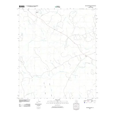
2010 Map of Bachelor Peak
USGS Topo · Published 2010About this map
Bachelor Peak anchors this Central Texas landscape in Burnet County, where the settlement of Watson sits at the intersection of farm roads and county routes. The terrain is defined by a dense network of drainages, most notably North Rocky Creek and South Rocky Creek, which carve through the limestone-rich country. Evidence of local industry and the physical landscape's utility is found in Stone Quarry Hollow and Postoak Hollow, suggesting a history of resource extraction and ranching. The map details a transition from primary highways to more rugged paths like Rattlesnake Trl and S Rocky Trl, reflecting the rural character of the region. Numerous named tributaries, such as Panther Den Branch and Olive Branch, illustrate the complex watershed that feeds the larger creek systems.
Find a feature on this map
23 named features on this map. Tap any name to fly to it.
Don’t see what you’re looking for? This feature index may not catch every label — zoom into the map to look around manually.
Map Details
Editions of this 2010 Bachelor Peak Map
This is the sole edition of this map. No revisions or reprints were ever made.
Other maps of this area

1887 · Lampasas
USGS Topo · 1:125,000

1887 · Burnet
USGS Topo · 1:125,000

1893 · Georgetown
USGS Topo · 1:125,000

1893 · Burnet
USGS Topo · 1:125,000

1894 · Lampasas
USGS Topo · 1:125,000

1894 · Gatesville
USGS Topo · 1:125,000

1903 · Burnet
USGS Topo · 1:125,000

1909 · Burnet
USGS Topo · 1:125,000

1947 · Fort Hood
USGS Topo · 1:62,500

1947 · Copperas Cove
USGS Topo · 1:24,000