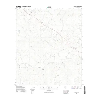
2016 Map of Bachelor Peak
USGS Topo · Published 2016About this map
Watson serves as the primary settlement hub on this Burnet County landscape, situated where several local roads converge near the southeast corner. The terrain is defined by the prominent Bachelor Peak to the northwest and a network of drainage systems including N Rocky Cr and S Rocky Cr. This survey illustrates a rural Texas environment where life is organized around specific geographic landmarks and family or community burial grounds, such as the Bachelor Peak Cem and Watson Cem. The presence of Stone Quarry Hollow suggests a history of local resource extraction, while named features like Postoak Hollow and Panther Den Br reflect the natural vegetation and wildlife character of the region. Transportation follows a mix of established highways like 183 and older local paths like Old 183 and S Rocky Trl, showing how modern infrastructure parallels the historical routes that once served remote homesteads and the Star Ranch.
Find a feature on this map
29 named features on this map. Tap any name to fly to it.
Don’t see what you’re looking for? This feature index may not catch every label — zoom into the map to look around manually.
Map Details
Editions of this 2016 Bachelor Peak Map
This is the sole edition of this map. No revisions or reprints were ever made.
Other maps of this area

1887 · Lampasas
USGS Topo · 1:125,000

1887 · Burnet
USGS Topo · 1:125,000

1893 · Georgetown
USGS Topo · 1:125,000

1893 · Burnet
USGS Topo · 1:125,000

1894 · Lampasas
USGS Topo · 1:125,000

1894 · Gatesville
USGS Topo · 1:125,000

1903 · Burnet
USGS Topo · 1:125,000

1909 · Burnet
USGS Topo · 1:125,000

1947 · Fort Hood
USGS Topo · 1:62,500

1947 · Copperas Cove
USGS Topo · 1:24,000