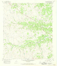
1967 Map of Bachelor Peak
USGS Topo · Published 1969About this map
Bachelor Peak rises as a prominent landmark in this Texas Hill Country landscape, captured just as the 1960s were drawing to a close. The terrain is defined by the drainage systems of North Rocky Creek and South Rocky Creek, which carve deep valleys and hollows like Stone Quarry Hollow and Postoak Hollow into the limestone-rich earth. This area, located in Burnet County, shows a rural economy centered on traditional land use and early resource extraction, evidenced by several Gravel Pits and a Quarry near the watercourses.
Find a feature on this map
17 named features on this map. Tap any name to fly to it.
Don’t see what you’re looking for? This feature index may not catch every label — zoom into the map to look around manually.
Map Details
Editions of this 1967 Bachelor Peak Map
This is the sole edition of this map. No revisions or reprints were ever made.
Other maps of this area

1887 · Lampasas
USGS Topo · 1:125,000

1887 · Burnet
USGS Topo · 1:125,000

1893 · Georgetown
USGS Topo · 1:125,000

1893 · Burnet
USGS Topo · 1:125,000

1894 · Lampasas
USGS Topo · 1:125,000

1894 · Gatesville
USGS Topo · 1:125,000

1903 · Burnet
USGS Topo · 1:125,000

1909 · Burnet
USGS Topo · 1:125,000

1947 · Fort Hood
USGS Topo · 1:62,500

1947 · Copperas Cove
USGS Topo · 1:24,000