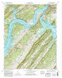
1968 Map of Bacon Gap
USGS Topo · Published 1981About this map
Watts Bar Lake and the confluence of the Clinch River and Tennessee River dominate this 1980 photorevised landscape in Roane County. The map details the growth of Kingston as its city boundaries expand south of Interstate 40, while maintaining deep roots at the historic Southwest Point and nearby Indian mounds. The topography is defined by the parallel elevations of Bacon Ridge and Smalley Ridge, creating narrow corridors like Barnard Narrows and Bacon Gap. Local history is preserved through dozens of family-named burial grounds including Christopher Cem, Durham Cem, and a Slave Cem located near the riverbanks. The transition from rural agriculture to residential development is evident in settlements like Chapman Grove and Midtown, while the Long Island Wildlife Management Area preserves the island terrain within the river channel.
Find a feature on this map
84 named features on this map. Tap any name to fly to it.
Don’t see what you’re looking for? This feature index may not catch every label — zoom into the map to look around manually.
Map Details
Editions of this 1968 Bacon Gap Map
4 editions found
Other maps of this area

1887 · Kingston
USGS Topo · 1:125,000

1891 · Kingston
USGS Topo · 1:125,000

1893 · Kingston
USGS Topo · 1:125,000

1895 · Loudon
USGS Topo · 1:125,000

1935 · Rockwood
USGS Topo · 1:24,000

1935 · Elverton
USGS Topo · 1:24,000

1935 · Harriman
USGS Topo · 1:24,000

1935 · Philadelphia
USGS Topo · 1:24,000

1936 · Cave Creek
USGS Topo · 1:24,000

1936 · Cardiff
USGS Topo · 1:24,000