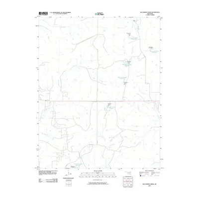
2009 Map of Baconrind Creek
USGS Topo · Published 2009About this map
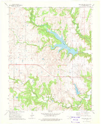
Baconrind Creek and Hominy Creek define the drainage patterns of this rural Osage County landscape at the turn of the 21st century. The map reveals a highly managed hydrologic system characterized by numerous artificial impoundments, such as Oknoname 113155 Reservoir and Oknoname 113156 Reservoir, each controlled by designated dams. These water management features are integrated into a terrain where livestock and land management appear central, notably at the T-Apple Ranch in the northern portion of the quadrangle. The intersection of local infrastructure, like Co RD 4551 and Co RD 5701, with natural waterways such as Wild Horse Creek and Little Chief Creek, illustrates the layout of ranching and rural life in this part of Oklahoma. The presence of these reservoirs highlights the reliance on engineered water sources for agriculture and land use in the region.
Find a feature on this map
25 named features on this map. Tap any name to fly to it.
Don’t see what you’re looking for? This feature index may not catch every label — zoom into the map to look around manually.
Map Details
Editions of this 2009 Baconrind Creek Map
This is the sole edition of this map. No revisions or reprints were ever made.
Other maps of this area

1909 · Pawhuska
USGS Topo · 1:125,000

1910 · Pawhuska
USGS Topo · 1:125,000

1916 · Foraker
USGS Topo · 1:62,500

1932 · Fairfax
USGS Topo · 1:62,500

1955 · Enid
USGS Topo · 1:250,000

1958 · Enid
USGS Topo · 1:250,000
1964 · Shidler
USGS Topo · 1:24,000
1973 · Happy Hollow
USGS Topo · 1:24,000
1973 · Pearsonia
USGS Topo · 1:24,000
1973 · Bluestem Lake
USGS Topo · 1:24,000