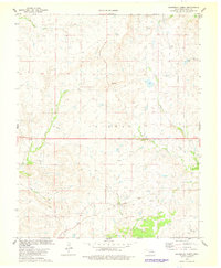
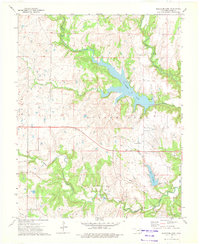
1978 Map of Baconrind Creek
USGS Topo · Published 1978About this map
The Fairfield Oil Field and numerous scattered Oil Wells dominate the southern portion of this landscape, reflecting the heavy industrial footprint of petroleum extraction within the Osage Indian Reservation during the 1970s. The topography is defined by a dense network of drainages, including the prominent Baconrind Creek and Hominy Creek, which carve through the terrain alongside Little Chief Creek and Wild Horse Creek. Settlement is sparse, with the T-Apple Ranch in the northeast and a lone Radio Tower providing some of the few named terrestrial landmarks among the rolling contours and section lines. The map captures an era where the natural creek systems like Bird Cr and Rock Creek intersected with an aging grid of oil infrastructure, including an old railroad grade and multiple Drill Hole sites.
Find a feature on this map
16 named features on this map. Tap any name to fly to it.
Don’t see what you’re looking for? This feature index may not catch every label — zoom into the map to look around manually.
Map Details
Editions of this 1978 Baconrind Creek Map
This is the sole edition of this map. No revisions or reprints were ever made.
Other maps of this area

1909 · Pawhuska
USGS Topo · 1:125,000

1910 · Pawhuska
USGS Topo · 1:125,000

1916 · Foraker
USGS Topo · 1:62,500

1932 · Fairfax
USGS Topo · 1:62,500

1955 · Enid
USGS Topo · 1:250,000

1958 · Enid
USGS Topo · 1:250,000
1964 · Shidler
USGS Topo · 1:24,000
1973 · Happy Hollow
USGS Topo · 1:24,000
1973 · Pearsonia
USGS Topo · 1:24,000
1973 · Bluestem Lake
USGS Topo · 1:24,000