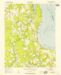
1948 Map of Bacons Castle
USGS Topo · Published 1953About this map
The Tidewater landscape near the James River transition to Burwells Bay is defined here by historic plantation sites and rural crossroads communities. Near the Surry and Isle of Wight county line, the map identifies Bacons Castle and its associated school, alongside the Lower Surry Ruins and Lower Surry Cemetery. These markers reflect centuries of continuous occupation in one of Virginia's oldest settled regions.
Find a feature on this map
52 named features on this map. Tap any name to fly to it.
Don’t see what you’re looking for? This feature index may not catch every label — zoom into the map to look around manually.
Map Details
Editions of this 1948 Bacons Castle Map
This is the sole edition of this map. No revisions or reprints were ever made.
Other maps of this area

1907 · Yorktown
USGS Topo · 1:62,500

1919 · Smithfield
USGS Topo · 1:62,500

1919 · Surry
USGS Topo · 1:62,500

1920 · Ivor
USGS Topo · 1:62,500

1943 · Yorktown
USGS Topo · 1:62,500

1943 · Richmond
USGS Topo · 1:250,000

1944 · Yorktown
USGS Topo · 1:24,000

1944 · Smithfield
USGS Topo · 1:24,000

1944 · Raynor
USGS Topo · 1:24,000
1945 · Raynor
USGS Topo · 1:31,680