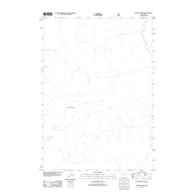
2012 Map of Badger Creek
USGS Topo · Published 2012About this map
Two Ocean Plateau dominates this high-altitude landscape in Park County, where the hydrological divide between the Atlantic and Pacific watersheds is traced through mountain drainages. The Yellowstone River flows through the northeast corner of the sheet, while the headwaters of the Snake River emerge in the south, illustrating the unique geography of the Continental Divide. This 2012 survey by the U.S. Geological Survey details a wilderness terrain defined by complex water systems, including the dramatic drop of Plateau Falls and the isolated waters of Mariposa Lake. A network of high-country streams like Badger Cr, Chipmunk Cr, and Lynx Cr carve through the plateau, providing a clear view of the undeveloped topography in this part of Wyoming.
Find a feature on this map
11 named features on this map. Tap any name to fly to it.
Don’t see what you’re looking for? This feature index may not catch every label — zoom into the map to look around manually.
Map Details
Editions of this 2012 Badger Creek Map
This is the sole edition of this map. No revisions or reprints were ever made.
Other maps of this area

1885 · Lake
USGS Topo · 1:125,000

1895 · Lake
USGS Topo · 1:125,000

1896 · Lake
USGS Topo · 1:125,000

1901 · Lake
USGS Topo · 1:125,000

1906 · Lake
USGS Topo · 1:125,000

1911 · Lake
USGS Topo · 1:125,000

1955 · Ashton
USGS Topo · 1:250,000

1958 · Ashton
USGS Topo · 1:250,000
1959 · Mount Hancock
USGS Topo · 1:62,500
1959 · Two Ocean Pass
USGS Topo · 1:62,500