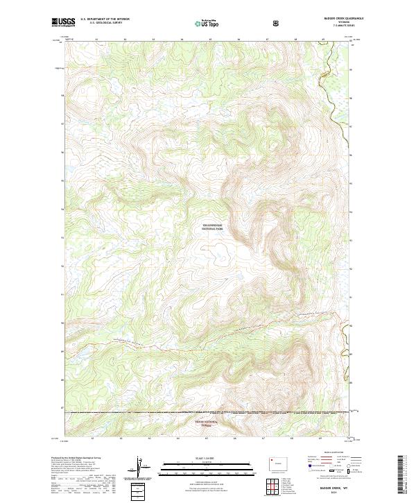
2021 Map of Badger Creek
USGS Topo · Published 2021About this map
Yellowstone National Park dominates the northern landscape of this survey, where the Yellowstone River enters from the east near the junction of Teton and Park Counties. This high-altitude wilderness is characterized by an intricate drainage system including Badger Creek, Chipmunk Creek, and Phlox Creek. The terrain reveals the headwaters of several critical Western waterways, notably the Snake River Headwaters Wild and Scenic River, which flows through the southern portion of the quadrangle within the Teton National Forest.
Find a feature on this map
19 named features on this map. Tap any name to fly to it.
Don’t see what you’re looking for? This feature index may not catch every label — zoom into the map to look around manually.
Map Details
Editions of this 2021 Badger Creek Map
This is the sole edition of this map. No revisions or reprints were ever made.
Other maps of this area

1885 · Lake
USGS Topo · 1:125,000

1895 · Lake
USGS Topo · 1:125,000

1896 · Lake
USGS Topo · 1:125,000

1901 · Lake
USGS Topo · 1:125,000

1906 · Lake
USGS Topo · 1:125,000

1911 · Lake
USGS Topo · 1:125,000

1955 · Ashton
USGS Topo · 1:250,000

1958 · Ashton
USGS Topo · 1:250,000
1959 · Mount Hancock
USGS Topo · 1:62,500
1959 · Two Ocean Pass
USGS Topo · 1:62,500