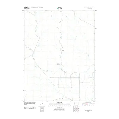
2010 Map of Badger Wash
USGS Topo · Published 2010About this map
Badger Wash and its complex system of drainage channels define this high desert landscape in Mesa County. Water management is the central theme of the terrain, as evidenced by the engineering of the Badger Detention Dam and the West Badger Detention Dam. These structures, along with the Government Highline Canal, illustrate the regional efforts to control seasonal runoff and support agricultural viability. The map traces the winding paths of West Salt Creek and East Salt Creek as they move toward the valley floor. Transportation is limited to a sparse grid of rural routes such as Baxter Pass Rd and Mitchell Rd, serving a region dominated by wide canyons like Prairie Canyon and seasonal washes.
Find a feature on this map
16 named features on this map. Tap any name to fly to it.
Don’t see what you’re looking for? This feature index may not catch every label — zoom into the map to look around manually.
Map Details
Editions of this 2010 Badger Wash Map
This is the sole edition of this map. No revisions or reprints were ever made.
Other maps of this area

1885 · East Tavaputs
USGS Topo · 1:250,000

1956 · Grand Junction
USGS Topo · 1:250,000

1959 · Grand Junction
USGS Topo · 1:250,000

1960 · Grand Junction
USGS Topo · 1:250,000

1962 · Grand Junction
USGS Topo · 1:250,000

1962 · Mack
USGS Topo · 1:24,000

1964 · Grand Junction
USGS Topo · 1:250,000

1965 · Grand Junction
USGS Topo · 1:250,000

1968 · Badger Wash
USGS Topo · 1:24,000
1968 · Carbonera
USGS Topo · 1:24,000