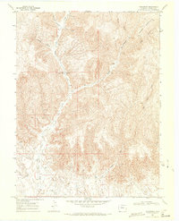
1968 Map of Carbonera
USGS Topo · Published 1971About this map
The high desert terrain of western Colorado's Garfield County is defined here by the winding course of West Salt Creek and the towering heights of Grassy Mountain. By the late 1960s, this landscape was primarily shaped by energy extraction and cattle ranching, as evidenced by numerous Gas Wells and the small Corral located near Buttermilk Canyon. The settlement of Carbonera (Site) appears as a vestigial point of interest along the creek, connected to the wider region by the Pipeline Trail and the remote Mitchell Road.
Find a feature on this map
21 named features on this map. Tap any name to fly to it.
Don’t see what you’re looking for? This feature index may not catch every label — zoom into the map to look around manually.
Map Details
Editions of this 1968 Carbonera Map
3 editions found
Other maps of this area

1885 · East Tavaputs
USGS Topo · 1:250,000

1956 · Grand Junction
USGS Topo · 1:250,000

1959 · Grand Junction
USGS Topo · 1:250,000

1960 · Grand Junction
USGS Topo · 1:250,000

1962 · Grand Junction
USGS Topo · 1:250,000

1964 · Grand Junction
USGS Topo · 1:250,000

1964 · Douglas Pass
USGS Topo · 1:24,000

1964 · Baxter Pass
USGS Topo · 1:24,000

1965 · Grand Junction
USGS Topo · 1:250,000
1966 · Rat Hole Ridge
USGS Topo · 1:24,000