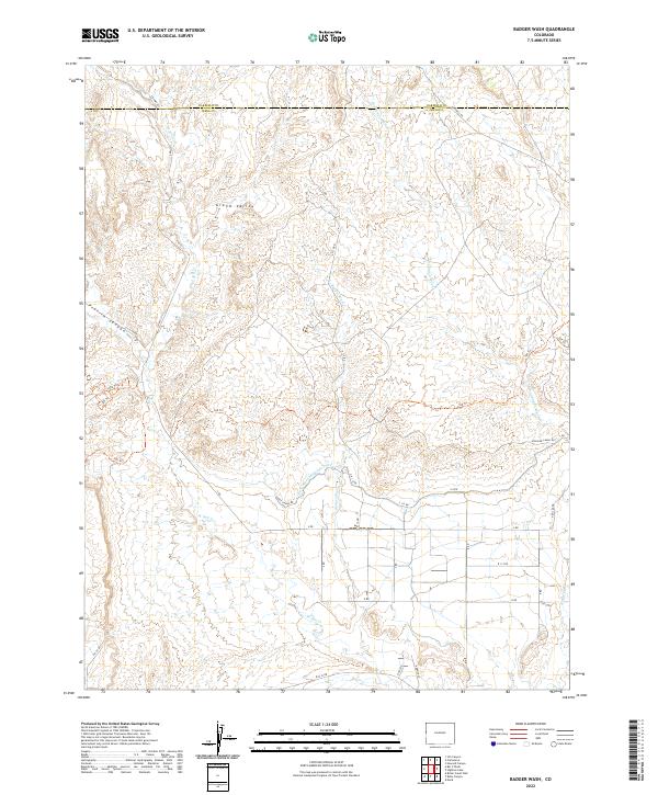
2022 Map of Badger Wash
USGS Topo · Published 2022About this map
The Grand Valley landscape of western Colorado is defined by a complex network of irrigation and drainage, anchored by the Government Highline Canal. This 2022 survey captures the arid terrain where Mesa and Garfield counties meet, showing a transition from the dissected uplands of Prairie Canyon to the managed agricultural lands below. The map details an extensive grid of section-line roads, such as 9 25/100 RD and Govt Canal Rd, which provide access to the various washes and creeks that feed the basin. Water management is the primary human imprint here, with W Salt Cr and Badger Wash winding through the topography, occasionally intersected by recreational or access routes like the 100 Trl. These features illustrate the intersection of historical water rights and modern land management in this high-desert environment.
Find a feature on this map
38 named features on this map. Tap any name to fly to it.
Don’t see what you’re looking for? This feature index may not catch every label — zoom into the map to look around manually.
Map Details
Editions of this 2022 Badger Wash Map
This is the sole edition of this map. No revisions or reprints were ever made.
Other maps of this area

1885 · East Tavaputs
USGS Topo · 1:250,000

1956 · Grand Junction
USGS Topo · 1:250,000

1959 · Grand Junction
USGS Topo · 1:250,000

1960 · Grand Junction
USGS Topo · 1:250,000

1962 · Grand Junction
USGS Topo · 1:250,000

1962 · Mack
USGS Topo · 1:24,000

1964 · Grand Junction
USGS Topo · 1:250,000

1965 · Grand Junction
USGS Topo · 1:250,000

1968 · Badger Wash
USGS Topo · 1:24,000
1968 · Carbonera
USGS Topo · 1:24,000