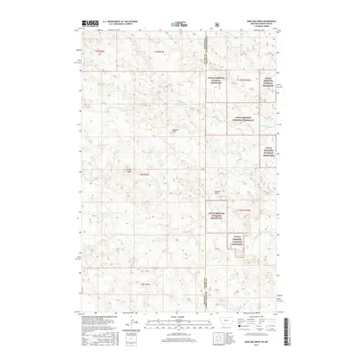
2017 Map of Badland Draw
USGS Topo · Published 2017About this map
The Montana-North Dakota border defines the eastern edge of this landscape, where the public lands of the Little Missouri National Grassland meet the high plains of Fallon County. This section of the borderlands is characterized by a network of seasonal drainages, most notably the eponymous Badland Draw, which cuts through the central terrain. Prominent landmarks such as Haystack Butte and the long stretch of Windy Ridge rise above the surrounding flats, offering clear navigational points in a region dominated by open range and ranching activity. The map reveals the intricate drainage patterns of the upper Missouri watershed, with Cannonball Cr and Johny Cr winding through the northern and central sections. Traces of early transportation routes are visible in the path of Old 16 Rd, which skirts the eastern state line, providing a glimpse into the rural infrastructure of this remote interstate corridor.
Find a feature on this map
19 named features on this map. Tap any name to fly to it.
Don’t see what you’re looking for? This feature index may not catch every label — zoom into the map to look around manually.
Map Details
Editions of this 2017 Badland Draw Map
This is the sole edition of this map. No revisions or reprints were ever made.
Other maps of this area

1953 · Miles City
USGS Topo · 1:250,000

1953 · Dickinson
USGS Topo · 1:250,000

1957 · Dickinson
USGS Topo · 1:250,000

1957 · Miles City
USGS Topo · 1:250,000

1958 · Miles City
USGS Topo · 1:250,000

1980 · Pretty Butte
USGS Topo · 1:24,000

1980 · Marmarth
USGS Topo · 1:24,000

1980 · Belfield
USGS Topo · 1:100,000

1981 · Baker
USGS Topo · 1:100,000

1981 · Buffalo Reservoir
USGS Topo · 1:24,000