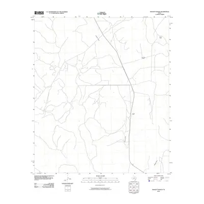
2010 Map of Baggett Ranch
USGS Topo · Published 2010About this map
Baggett Ranch serves as the namesake landmark for this segment of Crockett County, situated in a landscape defined by seasonal watercourses and expansive rangeland. The terrain is dominated by the complex drainage patterns of several significant draws, most notably Johnson Draw, which bisects the quadrangle from north to south alongside a local transit corridor. To the east, Tucker Draw and Live Oak Draw carve distinct paths through the high plains, while Baggett Draw marks the southern reaches of the area. This topographic representation emphasizes the fundamental relationship between isolated ranching outposts and the watershed systems essential for life in the Trans-Pecos region of Texas during the early 21st century.
Find a feature on this map
5 named features on this map. Tap any name to fly to it.
Don’t see what you’re looking for? This feature index may not catch every label — zoom into the map to look around manually.
Map Details
Editions of this 2010 Baggett Ranch Map
This is the sole edition of this map. No revisions or reprints were ever made.
Other maps of this area

1954 · Sonora
USGS Topo · 1:250,000

1958 · Sonora
USGS Topo · 1:250,000

1967 · Ozona
USGS Topo · 1:24,000

1967 · Baggett Ranch
USGS Topo · 1:24,000

1967 · Ozona SE
USGS Topo · 1:24,000

1967 · Hunt Ranch
USGS Topo · 1:24,000

1967 · Crockett Heights
USGS Topo · 1:24,000
1967 · Mitchell Canyon NE
USGS Topo · 1:24,000

1969 · Wild Horse Canyon
USGS Topo · 1:24,000

1970 · Howards Well NE
USGS Topo · 1:24,000