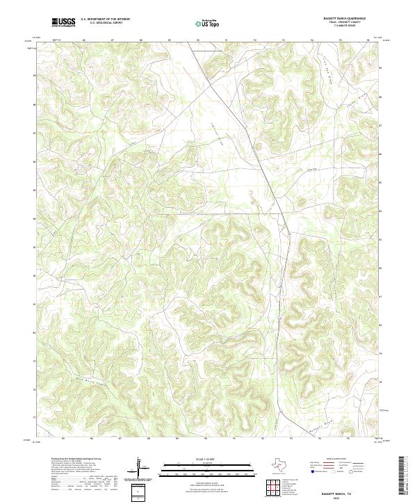
2022 Map of Baggett Ranch
USGS Topo · Published 2022About this map
Bert Mertz Canyon and a network of ephemeral drainage patterns characterize this section of the Edwards Plateau in Crockett County. The landscape is defined by the convergence of several major draws, including Johnson Draw and Live Oak Draw, which channel seasonal water across the high plains. Unlike more developed regions, the map shows a sparse network of infrastructure primarily serving the ranching economy, with Co Rd 401 and Ranch Rd 1973 providing the primary access through the terrain. The topographic detail reveals the complex relationship between the flat upland mesas and the deeply incised valleys of Baggett Draw and Tucker Draw. This 2022 survey serves as a precise record of the contemporary land use and natural hydrology in a region where cattle ranching and resource management remain the dominant forces.
Find a feature on this map
8 named features on this map. Tap any name to fly to it.
Don’t see what you’re looking for? This feature index may not catch every label — zoom into the map to look around manually.
Map Details
Editions of this 2022 Baggett Ranch Map
This is the sole edition of this map. No revisions or reprints were ever made.
Other maps of this area

1954 · Sonora
USGS Topo · 1:250,000

1958 · Sonora
USGS Topo · 1:250,000

1967 · Ozona
USGS Topo · 1:24,000

1967 · Baggett Ranch
USGS Topo · 1:24,000

1967 · Ozona SE
USGS Topo · 1:24,000

1967 · Hunt Ranch
USGS Topo · 1:24,000

1967 · Crockett Heights
USGS Topo · 1:24,000
1967 · Mitchell Canyon NE
USGS Topo · 1:24,000

1969 · Wild Horse Canyon
USGS Topo · 1:24,000

1970 · Howards Well NE
USGS Topo · 1:24,000