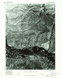
1975 Map of Baggs SE
USGS Topo · Published 1978About this map
Muddy Mtn dominates the northern skyline of this 1975 orthophotoquad, looking down upon the winding riparian corridor of the Little Snake River valley near the Wyoming-Colorado border. This aerial survey, captured in late August, provides a high-contrast visual record of the land surface, revealing the intricate drainage patterns and sharp topographic relief of the High Plains. The contrast between the dark, lush vegetation along the river bottomlands and the pale, arid benches of the surrounding terrain illustrates the critical importance of water for agriculture and settlement in this corner of Carbon County. While few structures are named, the intricate grid of section lines and range boundaries overlays a landscape of high desert ridges and alluvial plains, offering researchers an unfiltered look at the environment before modern energy developments altered the surface of the Little Snake River Basin.
Find a feature on this map
1 named feature on this map. Tap any name to fly to it.
Don’t see what you’re looking for? This feature index may not catch every label — zoom into the map to look around manually.
Map Details
Editions of this 1975 Baggs SE Map
This is the sole edition of this map. No revisions or reprints were ever made.
Other maps of this area

1916 · Craig
USGS Topo · 1:125,000

1932 · Savery
USGS Topo · 1:96,000

1940 · Savery
USGS Topo · 1:125,000

1954 · Rawlins
USGS Topo · 1:250,000

1954 · Craig
USGS Topo · 1:250,000

1957 · Craig
USGS Topo · 1:250,000

1957 · Baggs
USGS Topo · 1:62,500

1958 · Rawlins
USGS Topo · 1:250,000

1958 · Craig
USGS Topo · 1:250,000

1960 · Craig
USGS Topo · 1:250,000