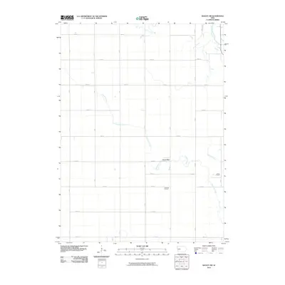
2010 Map of Bagley NW
USGS Topo · Published 2010About this map
Green Brier sits at the heart of this Greene County landscape, situated amidst a precise grid of rural roads and fertile Iowa farmland. The area is defined by the winding course of Greenbrier Creek, which meanders southeast toward its confluence with the North Raccoon River at the northeastern corner of the map. This topographic survey captures the agricultural layout of Grant Township as it stood in the early 21st century, dominated by a strict sectional road network ranging from 250th St down to 330th St. For those researching local family history, the map provides precise locations for both the Greenbrier Cemetery and the German Cemetery, which serve as permanent anchors for the community's ancestral roots near the banks of Dead Brier Creek.
Find a feature on this map
24 named features on this map. Tap any name to fly to it.
Don’t see what you’re looking for? This feature index may not catch every label — zoom into the map to look around manually.
Map Details
Editions of this 2010 Bagley NW Map
This is the sole edition of this map. No revisions or reprints were ever made.
Other maps of this area

1954 · Bagley
USGS Topo · 1:62,500

1954 · Omaha
USGS Topo · 1:250,000

1954 · Fort Dodge
USGS Topo · 1:250,000

1957 · Omaha
USGS Topo · 1:250,000

1957 · Fort Dodge
USGS Topo · 1:250,000

1958 · Omaha
USGS Topo · 1:250,000

1958 · Fort Dodge
USGS Topo · 1:250,000

1962 · Jefferson
USGS Topo · 1:62,500

1971 · Coon Rapids NE
USGS Topo · 1:24,000

1971 · Bayard
USGS Topo · 1:24,000