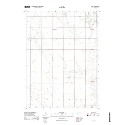
2018 Map of Bagley NW
USGS Topo · Published 2018About this map
Jefferson sits at the northeastern corner of this Iowa landscape, where the North Raccoon River winds through the corner of Grant Township. The terrain is defined by the agricultural grid of Greene County, etched into the land by a network of numbered section lines and rural routes. The drainage pattern of Greenbrier Cr cuts across the western and southern portions of the map, revealing the subtle relief of the local topography. This 2018 survey captures the contemporary layout of the region, showing the enduring structure of the township system and the proximity of the county seat to the open farmland and riparian corridors that characterize this part of the state.
Find a feature on this map
3 named features on this map. Tap any name to fly to it.
Don’t see what you’re looking for? This feature index may not catch every label — zoom into the map to look around manually.
Map Details
Editions of this 2018 Bagley NW Map
This is the sole edition of this map. No revisions or reprints were ever made.
Other maps of this area

1954 · Bagley
USGS Topo · 1:62,500

1954 · Omaha
USGS Topo · 1:250,000

1954 · Fort Dodge
USGS Topo · 1:250,000

1957 · Omaha
USGS Topo · 1:250,000

1957 · Fort Dodge
USGS Topo · 1:250,000

1958 · Omaha
USGS Topo · 1:250,000

1958 · Fort Dodge
USGS Topo · 1:250,000

1962 · Jefferson
USGS Topo · 1:62,500

1971 · Coon Rapids NE
USGS Topo · 1:24,000

1971 · Bayard
USGS Topo · 1:24,000