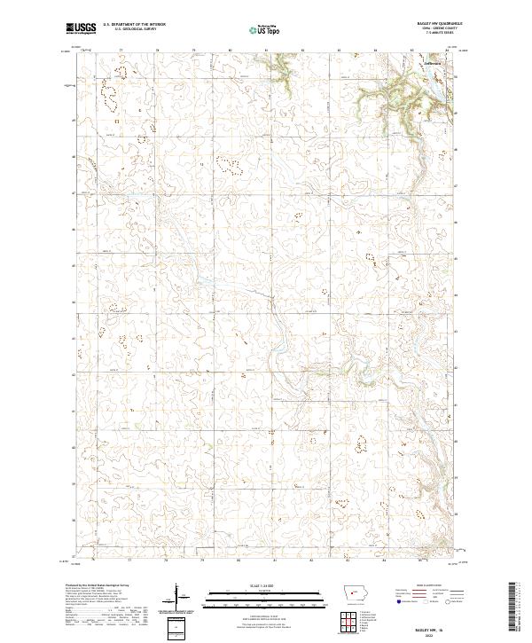
2022 Map of Bagley NW
USGS Topo · Published 2022About this map
Jefferson sits in the northeastern corner of this Greene County landscape, where the North Raccoon River winds through the river bottom. The terrain is defined by the drainage patterns of Greenbrier Cr and Dead Brier Cr, which cut through the high plains of west-central Iowa. The map reveals the rigid structure of the Public Land Survey System, with a dense grid of gravel and paved roads marking section lines every mile. Principal routes like Co Hwy E57 and Co Hwy E63 intersect with a series of numbered township roads, such as 300th St and 320th St, which provide access to the dispersed farmsteads characteristic of the region's agricultural economy. This 2022 survey documents the contemporary rural infrastructure within the boundaries of townships t83n r31w and t82n r31w.
Find a feature on this map
28 named features on this map. Tap any name to fly to it.
Don’t see what you’re looking for? This feature index may not catch every label — zoom into the map to look around manually.
Map Details
Editions of this 2022 Bagley NW Map
This is the sole edition of this map. No revisions or reprints were ever made.
Other maps of this area

1954 · Bagley
USGS Topo · 1:62,500

1954 · Omaha
USGS Topo · 1:250,000

1954 · Fort Dodge
USGS Topo · 1:250,000

1957 · Omaha
USGS Topo · 1:250,000

1957 · Fort Dodge
USGS Topo · 1:250,000

1958 · Omaha
USGS Topo · 1:250,000

1958 · Fort Dodge
USGS Topo · 1:250,000

1962 · Jefferson
USGS Topo · 1:62,500

1971 · Coon Rapids NE
USGS Topo · 1:24,000

1971 · Bayard
USGS Topo · 1:24,000