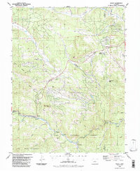
1987 Map of Bailey
USGS Topo · Published 1987About this map
The North Fork South Platte River carves a deep path through this portion of the Front Range, dictating the settlement patterns and transport corridors for mountain communities in the late 1980s. The town of Bailey serves as a primary hub along the river, flanked by smaller historic locales such as Insmont, Estabrook, and Glenisle. This survey illustrates the transition from traditional mountain hamlets to more modern recreational and residential developments, exemplified by the appearance of Wandcrest Park and the Heliport near Pine Junction.
Find a feature on this map
48 named features on this map. Tap any name to fly to it.
Don’t see what you’re looking for? This feature index may not catch every label — zoom into the map to look around manually.
Map Details
Editions of this 1987 Bailey Map
2 editions found
Other maps of this area

1893 · Platte Canyon
USGS Topo · 1:125,000

1899 · West Denver
USGS Topo · 1:125,000

1903 · Georgetown
USGS Topo · 1:62,500

1905 · Georgetown
USGS Topo · 1:62,500

1945 · Pine
USGS Topo · 1:24,000

1945 · Bailey
USGS Topo · 1:24,000

1945 · Shawnee
USGS Topo · 1:24,000

1948 · Pine
USGS Topo · 1:24,000

1948 · Shawnee
USGS Topo · 1:24,000

1949 · Bailey
USGS Topo · 1:24,000