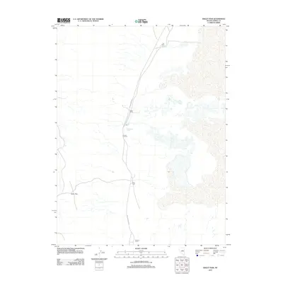
2012 Map of Bailey Pass
USGS Topo · Published 2012About this map
Romano Post Office serves as a small anchor point in this high-desert basin within Eureka County, where isolated ranching operations define the settlement pattern. The landscape is characterized by its reliance on critical water sources like Shipley Hot Spring and Siri Ranch Spring, which sustain the scattered holdings of the Siri Ranch, Sadler Ranch, and Bailey Ranch. These family-named landmarks are connected by the Sadler-Siri Union road, tracing a route through the valley floor toward Bailey Pass. The arrangement of these ranching estates, including the Romano Ranch to the south, reflects the enduring spatial logic of the Great Basin, where life and commerce are dictated by the presence of springs and the passes that allow movement across the basin-and-range topography.
Find a feature on this map
9 named features on this map. Tap any name to fly to it.
Don’t see what you’re looking for? This feature index may not catch every label — zoom into the map to look around manually.
Map Details
Editions of this 2012 Bailey Pass Map
This is the sole edition of this map. No revisions or reprints were ever made.
Other maps of this area

1926 · Roberts Mountains
USGS Topo · 1:250,000

1929 · Roberts Mountains
USGS Topo · 1:250,000

1934 · Jiggs
USGS Topo · 1:125,000

1937 · Mineral Hill
USGS Topo · 1:48,000

1937 · Jiggs
USGS Topo · 1:125,000

1943 · Mineral Hill
USGS Topo · 1:62,500

1949 · Garden Valley
USGS Topo · 1:62,500

1951 · Garden Valley
USGS Topo · 1:62,500

1955 · Millett
USGS Topo · 1:250,000

1955 · Winnemucca
USGS Topo · 1:250,000