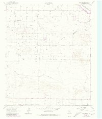
1962 Map of Baileyboro NE
USGS Topo · Published 1981About this map
Blackwater Draw and Progress Draw cut broad, shallow paths across the high plains of the Texas Panhandle in this 1962 survey. The landscape is defined by an intensive agricultural and energy footprint, evidenced by the high density of wells and the network of fence lines that parcel the terrain. While the area is largely rural, the presence of Wasson Camp suggests a specific localized gathering point or industrial outpost during this era. Transportation and regional connectivity are centered in the northeast corner, where the Santa Fe and Panhandle and Santa Fe rail lines traverse the corner of the map. These tracks, paired with a grid of unimproved and medium-duty roads, illustrate the infrastructure required to support the local extraction and ranching economy mid-century.
Find a feature on this map
6 named features on this map. Tap any name to fly to it.
Don’t see what you’re looking for? This feature index may not catch every label — zoom into the map to look around manually.
Map Details
Editions of this 1962 Baileyboro NE Map
2 editions found
Other maps of this area

1954 · Clovis
USGS Topo · 1:250,000

1958 · Clovis
USGS Topo · 1:250,000

1962 · Muleshoe
USGS Topo · 1:24,000

1962 · Needmore
USGS Topo · 1:24,000

1962 · Stegall
USGS Topo · 1:24,000

1962 · Birdwell Ranch
USGS Topo · 1:24,000

1962 · Baileyboro NE
USGS Topo · 1:24,000

1962 · Baileyboro
USGS Topo · 1:24,000

1963 · Lariat
USGS Topo · 1:24,000

1963 · Lazbuddie SW
USGS Topo · 1:24,000