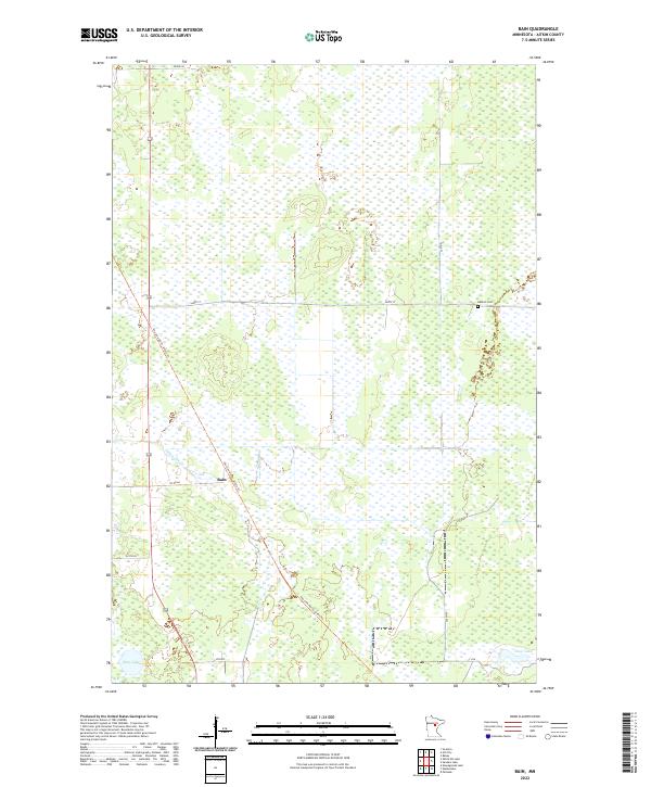
2022 Map of Bain
USGS Topo · Published 2022About this map
Bain centers this Aitkin County landscape, situated along the historic corridor of the Soo Line North: Aitkin Trl. The map reflects a region defined by extensive wetlands and water management, with the corridor cutting a diagonal path through the township sections. Local history is anchored by the Hebron Cem to the east and the winding course of White Elk Cr. In the southern reaches, the terrain transitions toward larger water bodies including Sitas Lake and Clear Lake. This modern survey illustrates the persistent rural structure of the area, where the legacy of the railroad survives as a prominent trail system, connecting the small settlement of Bain to the broader county road network via Co Rd 68.
Find a feature on this map
19 named features on this map. Tap any name to fly to it.
Don’t see what you’re looking for? This feature index may not catch every label — zoom into the map to look around manually.
Map Details
Editions of this 2022 Bain Map
This is the sole edition of this map. No revisions or reprints were ever made.
Other maps of this area

1914 · Aitkin
USGS Topo · 1:62,500

1915 · Aitkin
USGS Topo · 1:62,500

1953 · Duluth
USGS Topo · 1:250,000

1958 · Duluth
USGS Topo · 1:250,000

1970 · Rabey
USGS Topo · 1:24,000

1970 · Palisade
USGS Topo · 1:24,000

1970 · Sanders Lake
USGS Topo · 1:24,000

1970 · Bain
USGS Topo · 1:24,000
1970 · Hill City
USGS Topo · 1:24,000

1970 · White Elk Lake
USGS Topo · 1:24,000