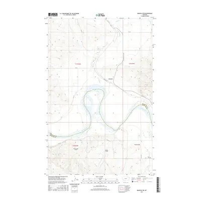
2017 Map of Bainville SW
USGS Topo · Published 2017About this map
The Missouri River cuts a wide, meandering path through this borderland of Roosevelt and Richland Counties, defining a landscape of deep drainage channels and alluvial flats. The small community of Lakeside sits at the junction of S Bainville Rd and the Bainville-Snowden Rd, serving as a central point for the surrounding ranching and agricultural lands. North of the river, the terrain is carved by Little Muddy Cr and Shotgun Cr, while the southern reaches feature the distinct depressions of Sheep Camp Coulee and Benson Coulee. This 2017 survey documents the local road network, including Co Rd 147, which provides access across the broken ground south of the river. For those researching local history, the map identifies the Nohly Cem near the river's southern bend, a quiet landmark in this sparsely populated stretch of eastern Montana.
Find a feature on this map
21 named features on this map. Tap any name to fly to it.
Don’t see what you’re looking for? This feature index may not catch every label — zoom into the map to look around manually.
Map Details
Editions of this 2017 Bainville SW Map
This is the sole edition of this map. No revisions or reprints were ever made.
Other maps of this area

1909 · Glendive
USGS Topo · 1:250,000

1954 · Glendive
USGS Topo · 1:250,000

1954 · Wolf Point
USGS Topo · 1:250,000

1957 · Glendive
USGS Topo · 1:250,000

1958 · Wolf Point
USGS Topo · 1:250,000

1958 · Glendive
USGS Topo · 1:250,000
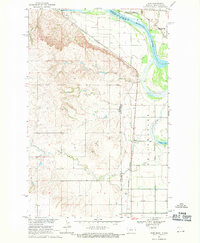
1968 · Dore
USGS Topo · 1:24,000

1968 · Bainville SE
USGS Topo · 1:24,000

1969 · Cedar Coulee
USGS Topo · 1:24,000

1969 · Bainville SW
USGS Topo · 1:24,000