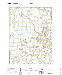
2017 Map of Baird Inlet A-1 NE
USGS Topo · Published 2017About this map
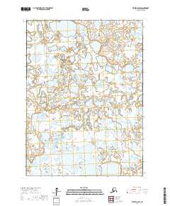
The village of Eek serves as the focal point for this 2017 survey, situated along the meandering path of the Eek River in the Yukon-Kuskokwim Delta. The map illustrates a landscape dominated by complex hydrological networks, where the river winds through an intricate system of wetlands and small tundra lakes. Vital local infrastructure is clearly documented, including the Eek Airport and Tank Farm Road, reflecting the logistics of a roadless environment dependent on air and water transport. This survey provides a precise record of the shoreline and drainage patterns near the Eek River at a time of ongoing environmental monitoring in the Bethel Census Area.
Find a feature on this map
8 named features on this map. Tap any name to fly to it.
Don’t see what you’re looking for? This feature index may not catch every label — zoom into the map to look around manually.
Map Details
Editions of this 2017 Baird Inlet A-1 NE Map
This is the sole edition of this map. No revisions or reprints were ever made.
Other maps of this area

1950 · Bethel
USGS Topo · 1:250,000

1951 · Baird Inlet
USGS Topo · 1:250,000

1954 · Bethel B-8
USGS Topo · 1:63,360
1954 · Bethel A-8
USGS Topo · 1:63,360

1954 · Baird Inlet
USGS Topo · 1:250,000

1954 · Baird Inlet B-1
USGS Topo · 1:63,360
1954 · Baird Inlet A-1
USGS Topo · 1:63,360

1980 · Bethel
USGS Topo · 1:250,000
2017 · Baird Inlet A-1 SE
USGS Topo · 1:25,000
2017 · Bethel A-8 SW
USGS Topo · 1:25,000