
1954 Map of Baird Inlet D-8
USGS Topo · Published 1971About this map
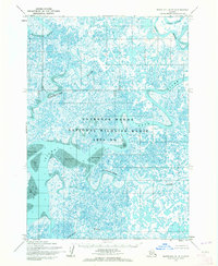
Nelson Island and the broad Kumlunak Peninsula dominate this mid-century coastal survey, where the massive Ninglick River meets the Bering Sea. The landscape is a complex of estuarine environments characterized by extensive areas of sand and mud and tidal sloughs. Human presence is documented at Newtok and through former habitation points such as Keyaluvik (Site) and Nunakak Camp (Site), suggesting a seasonal or shifting settlement pattern common to this region of the Yukon-Kuskokwim Delta.
Find a feature on this map
16 named features on this map. Tap any name to fly to it.
Don’t see what you’re looking for? This feature index may not catch every label — zoom into the map to look around manually.
Map Details
Editions of this 1954 Baird Inlet D-8 Map
This is the sole edition of this map. No revisions or reprints were ever made.
Other maps of this area

1951 · Marshall
USGS Topo · 1:250,000

1951 · Hooper Bay
USGS Topo · 1:250,000

1951 · Nunivak Island
USGS Topo · 1:250,000

1951 · Baird Inlet
USGS Topo · 1:250,000

1953 · Hooper Bay
USGS Topo · 1:250,000

1954 · Nunivak Island
USGS Topo · 1:250,000
1954 · Marshall A-8
USGS Topo · 1:63,360
1954 · Marshall A-7
USGS Topo · 1:63,360

1954 · Baird Inlet C-7
USGS Topo · 1:63,360

1954 · Baird Inlet D-7
USGS Topo · 1:63,360