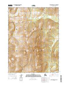
2015 Map of Baird Mountains A-3 SE
USGS Topo · Published 2015About this map
Canyon Creek and Central Creek drain the northern reaches of this remote Arctic interior during the mid-2010s, following the drainage patterns of the Baird Mountains. The map reveals a landscape defined by sharp elevation shifts and steep-walled valleys, particularly where Napautokik Creek flows southward through the bottom center of the quadrangle. This area, within the Northwest Arctic Borough, is marked by a complete lack of human structures or established roads, instead showing the complex public land survey system grid lines of t20n r7w, t20n r6w, t19n r7w, and t19n r6w. The topography serves as a primary reference for the untouched drainage basins that feed into the larger river systems of the Alaska wilderness.
Find a feature on this map
7 named features on this map. Tap any name to fly to it.
Don’t see what you’re looking for? This feature index may not catch every label — zoom into the map to look around manually.
Map Details
Editions of this 2015 Baird Mountains A-3 SE Map
This is the sole edition of this map. No revisions or reprints were ever made.
Other maps of this area

1951 · Baird Mountains
USGS Topo · 1:250,000

1951 · Selawik
USGS Topo · 1:250,000

1955 · Selawik D-2
USGS Topo · 1:63,360

1955 · Baird Mountains A-2
USGS Topo · 1:63,360

1955 · Selawik D-3
USGS Topo · 1:63,360

1955 · Baird Mountains A-3
USGS Topo · 1:63,360

1956 · Baird Mountains
USGS Topo · 1:250,000

1957 · Selawik
USGS Topo · 1:250,000

1965 · Baird Mountains
USGS Topo · 1:250,000
2015 · Baird Mountains A-3 SW
USGS Topo · 1:25,000