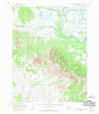
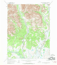
1955 Map of Baird Mountains A-5
USGS Topo · Published 1970About this map
The Kiana Hills dominate the southern portion of this sub-Arctic landscape, rising toward the prominent Deviation Peak. This high ground separates several drainage systems, with the Squirrel River and its North Fork winding through the northern lowlands. These waterways are characterized by extensive meandering and oxbow formations, indicating a dynamic floodplain environment within the Northwest Arctic region.
Find a feature on this map
6 named features on this map. Tap any name to fly to it.
Don’t see what you’re looking for? This feature index may not catch every label — zoom into the map to look around manually.
Map Details
Editions of this 1955 Baird Mountains A-5 Map
2 editions found
Other maps of this area

1951 · Baird Mountains
USGS Topo · 1:250,000

1951 · Selawik
USGS Topo · 1:250,000

1951 · Selawik D-6
USGS Topo · 1:63,360

1952 · Selawik D-6
USGS Topo · 1:63,360

1955 · Selawik D-4
USGS Topo · 1:63,360

1955 · Selawik D-5
USGS Topo · 1:63,360
1955 · Baird Mountains A-5
USGS Topo · 1:63,360
1955 · Baird Mountains A-6
USGS Topo · 1:63,360
1955 · Baird Mountains B-6
USGS Topo · 1:63,360
1955 · Baird Mountains B-5
USGS Topo · 1:63,360