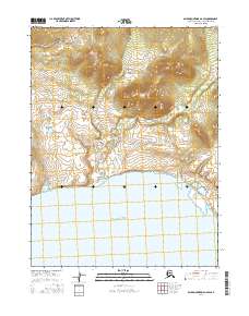
2016 Map of Baird Mountains A-6 SW
USGS Topo · Published 2016About this map
Hotham Inlet defines the southern extent of this landscape, where the waters of the Inlet meet the northern tundra. The terrain transition is striking, moving from the open tidal waters and wetlands into a series of rising hills and peaks. These elevations are marked by significant contour changes across the northern portion of the quadrangle, particularly within the sections of t20n r15w and t20n r14w. This specific survey emphasizes the vast, uninhabited character of the Northwest Arctic at this moment in the early twenty-first century, documenting the precise relationship between the shoreline and the rising Baird Mountains foothills without the presence of permanent named settlements or roads.
Find a feature on this map
5 named features on this map. Tap any name to fly to it.
Don’t see what you’re looking for? This feature index may not catch every label — zoom into the map to look around manually.
Map Details
Editions of this 2016 Baird Mountains A-6 SW Map
This is the sole edition of this map. No revisions or reprints were ever made.
Other maps of this area

1951 · Baird Mountains
USGS Topo · 1:250,000

1951 · Selawik
USGS Topo · 1:250,000

1951 · Noatak
USGS Topo · 1:250,000

1951 · Kotzebue
USGS Topo · 1:250,000

1951 · Kotzebue D-1
USGS Topo · 1:63,360

1951 · Selawik D-6
USGS Topo · 1:63,360

1952 · Selawik D-6
USGS Topo · 1:63,360

1955 · Noatak
USGS Topo · 1:250,000
1955 · Baird Mountains A-6
USGS Topo · 1:63,360
1955 · Noatak A-1
USGS Topo · 1:63,360