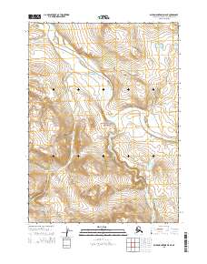
2015 Map of Baird Mountains D-5 NE
USGS Topo · Published 2015About this map
Noatak National Preserve encompasses the majority of this landscape, protecting a massive watershed where the wide, braided channels of the Noatak River dominate the central valley. Several significant tributaries feed into the primary river system here, including Maiyumerak Cr in the northwest and Pongo Cr to the south. The drainage patterns revealed by this 2015 survey highlight the complex hydrology of the Arctic, where the Kaluktavik River joins the system at the eastern edge and the Akikukchiak Cr flows northward through the southern hills. This map illustrates the remote character of the Baird Mountains region, defined entirely by its water systems and the natural boundaries of the preserve, with no roads or permanent settlements recorded within the quadrangle.
Find a feature on this map
10 named features on this map. Tap any name to fly to it.
Don’t see what you’re looking for? This feature index may not catch every label — zoom into the map to look around manually.
Map Details
Editions of this 2015 Baird Mountains D-5 NE Map
This is the sole edition of this map. No revisions or reprints were ever made.
Other maps of this area

1951 · Baird Mountains
USGS Topo · 1:250,000

1951 · Misheguk Mountain
USGS Topo · 1:250,000

1955 · Baird Mountains D-4
USGS Topo · 1:63,360

1955 · Baird Mountains D-5
USGS Topo · 1:63,360
1955 · Misheguk Mountain A-4
USGS Topo · 1:63,360

1956 · Misheguk Mountain
USGS Topo · 1:250,000

1956 · Baird Mountains
USGS Topo · 1:250,000

1965 · Baird Mountains
USGS Topo · 1:250,000
2014 · Baird Mountains D-4 NW
USGS Topo · 1:25,000
2014 · Baird Mountains D-4 SW
USGS Topo · 1:25,000