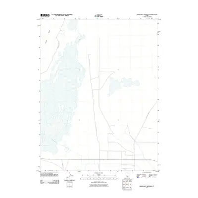
2010 Map of Baker Hot Springs
USGS Topo · Published 2010About this map
Baker Hot Springs and the expansive geological remnants of the Old River Bed dominate this arid section of the Sevier Desert. The landscape is defined by its thermal features and the flat, sprawling reaches of Crater Bench, showing the minimal human encroachment into this mineral-rich environment. Modern infrastructure is limited to a grid of rural routes including N 8000 West St and N 4000 W, which navigate the wide basins and alkaline flats. The presence of the hydrothermal springs near Baker Hot Springs Rd provides a focal point for geothermal activity in an otherwise austere desert setting. This survey captures the intersection of desert geology and the remote road networks that connect these thermal landmarks to the broader region via Desert Mountain Rd.
Find a feature on this map
7 named features on this map. Tap any name to fly to it.
Don’t see what you’re looking for? This feature index may not catch every label — zoom into the map to look around manually.
Map Details
Editions of this 2010 Baker Hot Springs Map
This is the sole edition of this map. No revisions or reprints were ever made.
Other maps of this area

1885 · Sevier Desert
USGS Topo · 1:250,000

1953 · Delta
USGS Topo · 1:250,000

1958 · Delta
USGS Topo · 1:250,000

1962 · Delta
USGS Topo · 1:250,000

1962 · Delta
USGS Topo · 1:62,500

1971 · Smelter Knolls East
USGS Topo · 1:24,000

1971 · Baker Hot Springs
USGS Topo · 1:24,000

1971 · Rain Lake
USGS Topo · 1:24,000

1971 · Crater Bench Reservoir
USGS Topo · 1:24,000

1971 · Fumarole Butte
USGS Topo · 1:24,000