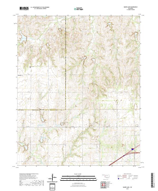
2022 Map of Baker Lake
USGS Topo · Published 2022About this map
Berlin serves as the focal point for this western Oklahoma landscape, situated just south of the boundary between Roger Mills Co Beckham Co. This modern topographic survey highlights a region defined by extensive watershed management, evident in the string of numbered reservoirs such as Timbercreek Site 4 Reservoir and Timber Cr Site 5 Reservoir along the winding course of Timber Cr. For genealogists and local historians, the Berlin Cem north of the settlement provides a primary point for family research.
Find a feature on this map
35 named features on this map. Tap any name to fly to it.
Don’t see what you’re looking for? This feature index may not catch every label — zoom into the map to look around manually.
Map Details
Editions of this 2022 Baker Lake Map
This is the sole edition of this map. No revisions or reprints were ever made.
Other maps of this area

1955 · Clinton
USGS Topo · 1:250,000

1957 · Clinton
USGS Topo · 1:250,000

1960 · Cheyenne
USGS Topo · 1:62,500

1960 · Sayre
USGS Topo · 1:62,500

1960 · Hammon
USGS Topo · 1:62,500

1961 · Elk City
USGS Topo · 1:62,500

1984 · Foss Reservoir
USGS Topo · 1:100,000

1985 · Elk City
USGS Topo · 1:100,000

1987 · Big Kiowa Creek
USGS Topo · 1:24,000

1987 · Elk City
USGS Topo · 1:24,000