
1987 Map of Big Kiowa Creek
USGS Topo · Published 1987About this map
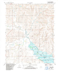
Washita River meanders across the northern reaches of this Western Oklahoma landscape, which is defined by an extensive network of petroleum extraction and rural land use. The presence of numerous Gas Wells throughout the territory illustrates the mid-1980s energy economy in Roger Mills County. Transportation legacy is visible in the Old Railroad Grade that cuts through the northern sections, marking a transition in how goods and people moved through this prairie terrain. Local heritage is anchored by dispersed burial grounds including Red Hill Cem near the river, Kiowa Cem centrally located near Little Kiowa Creek, and Carpenter Cem to the south. The drainage patterns of Big Kiowa Creek and White Shield Creek provide a detailed look at the hydraulic layout of the region before it crosses into Beckham and Custer counties.
Find a feature on this map
14 named features on this map. Tap any name to fly to it.
Don’t see what you’re looking for? This feature index may not catch every label — zoom into the map to look around manually.
Map Details
Editions of this 1987 Big Kiowa Creek Map
This is the sole edition of this map. No revisions or reprints were ever made.
Other maps of this area

1955 · Clinton
USGS Topo · 1:250,000

1957 · Clinton
USGS Topo · 1:250,000

1960 · Cheyenne
USGS Topo · 1:62,500

1960 · Sayre
USGS Topo · 1:62,500

1960 · Hammon
USGS Topo · 1:62,500

1961 · Elk City
USGS Topo · 1:62,500

1984 · Foss Reservoir
USGS Topo · 1:100,000

1985 · Elk City
USGS Topo · 1:100,000

1987 · Elk City
USGS Topo · 1:24,000
1987 · Mc Clure
USGS Topo · 1:24,000