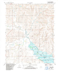
1987 Map of Mc Clure
USGS Topo · Published 1987About this map
The Washita River meanders through this Western Oklahoma landscape, feeding into the northern reaches of Foss Reservoir. In the late 1980s, much of the river valley was protected within the Washita National Wildlife Refuge, which includes dedicated recreation areas and a Gaging Sta. The presence of several stretches of Old Railroad Grade cutting across the terrain north of the river highlights a shifting transportation network, where former rail lines have given way to energy infrastructure, evidenced by numerous Gas Wells and pipelines. The small community of McClure sits near the riverbanks, while the settlement of Moorewood occupies the higher ground to the north. For those tracing family history, the Bethel Cem is located near the town of Hammon on the southwestern edge of the quadrangle, situated near a Sand and Gravel Pit.
Find a feature on this map
24 named features on this map. Tap any name to fly to it.
Don’t see what you’re looking for? This feature index may not catch every label — zoom into the map to look around manually.
Map Details
Editions of this 1987 Mc Clure Map
This is the sole edition of this map. No revisions or reprints were ever made.
Other maps of this area

1955 · Clinton
USGS Topo · 1:250,000

1957 · Clinton
USGS Topo · 1:250,000

1957 · Butler
USGS Topo · 1:62,500

1960 · Hammon
USGS Topo · 1:62,500

1961 · Leedey
USGS Topo · 1:62,500

1962 · Aledo
USGS Topo · 1:62,500

1976 · Butler NW
USGS Topo · 1:24,000

1976 · Butler SW
USGS Topo · 1:24,000
1983 · Foss Dam
USGS Topo · 1:24,000
1983 · Butler
USGS Topo · 1:24,000