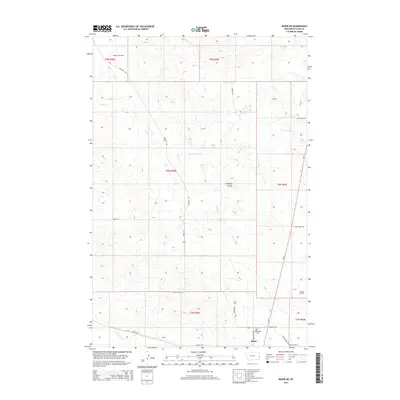
2014 Map of Baker NE
USGS Topo · Published 2014About this map
Monarch Oil Field and Pennel Oil Field anchor the landscape north of Baker, illustrating the ongoing energy production in this corner of Fallon County. The terrain is defined by drainages like Pennel Cr and Cottonwood Cr that wind through the prairie toward Antelope Butte. Transportation and industry define the southern edge of the map, where the Burlington Northern Railroad and Mt-7 pass near the Bonnievale Cem. A network of unpaved tracks, including Anticline Rd and Johny Creek Trl, connects the remote oil operations and grazing lands. This map provides a clear record of the rural infrastructure and land management patterns of the early twenty-first century, showing the intersection of historic ranching routes and modern industrial extraction.
Find a feature on this map
24 named features on this map. Tap any name to fly to it.
Don’t see what you’re looking for? This feature index may not catch every label — zoom into the map to look around manually.
Map Details
Editions of this 2014 Baker NE Map
This is the sole edition of this map. No revisions or reprints were ever made.
Other maps of this area

1953 · Miles City
USGS Topo · 1:250,000

1957 · Miles City
USGS Topo · 1:250,000

1958 · Miles City
USGS Topo · 1:250,000

1981 · Baker
USGS Topo · 1:100,000

1981 · Baker NE
USGS Topo · 1:24,000

1981 · Buffalo Reservoir
USGS Topo · 1:24,000

1981 · Baker
USGS Topo · 1:24,000

1981 · South Sandstone Reservoir
USGS Topo · 1:24,000

1981 · Lawrence Creek East
USGS Topo · 1:24,000

1981 · Baker NW
USGS Topo · 1:24,000