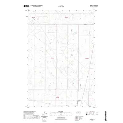
2020 Map of Baker NE
USGS Topo · Published 2020About this map
Bonnievale Cem and the northern outskirts of Baker define the southern landscape of this Fallon County survey. The terrain is characterized by a network of ephemeral drainage systems and ranch roads that crisscross the prairie, including Pennel Cr, Cottonwood Cr, and Sandstone Cr. Named landmarks like Antelope Butte provide points of elevation amidst the expansive township and range grid. The presence of Oilfield Rd and Shell Oil Rd highlights the region's industrial connection to resource extraction, while a series of trails such as Johny Creek Trl and Goble Trl suggest a more remote pattern of land use. This map serves as a detailed record of the intersections between livestock grazing territory and the energy economy in eastern Montana during the early twenty-first century.
Find a feature on this map
24 named features on this map. Tap any name to fly to it.
Don’t see what you’re looking for? This feature index may not catch every label — zoom into the map to look around manually.
Map Details
Editions of this 2020 Baker NE Map
This is the sole edition of this map. No revisions or reprints were ever made.
Other maps of this area

1953 · Miles City
USGS Topo · 1:250,000

1957 · Miles City
USGS Topo · 1:250,000

1958 · Miles City
USGS Topo · 1:250,000

1981 · Baker
USGS Topo · 1:100,000

1981 · Baker NE
USGS Topo · 1:24,000

1981 · Buffalo Reservoir
USGS Topo · 1:24,000

1981 · Baker
USGS Topo · 1:24,000

1981 · South Sandstone Reservoir
USGS Topo · 1:24,000

1981 · Lawrence Creek East
USGS Topo · 1:24,000

1981 · Baker NW
USGS Topo · 1:24,000