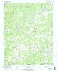
1968 Map of Bakersfield
USGS Topo · Published 1969About this map
Bakersfield sits at the southeastern edge of this Ozark County landscape, where the town plan centers near Plumb Bayou and several mines. The 1960s terrain is defined by a dense network of hollows and ridges, such as Butram Ridge and Hasty Pudding Hollow, which dictated the winding paths of rural roads. Smaller communities and rural social centers appear as isolated landmarks, including Elijah to the north and a series of country churches like Mineral Point Ch and Baptist Hill Ch. In the southwest corner, the map shows the upper reaches of Norfork Lake, noting areas subject to controlled inundation. Along the northern border, the North Fork of the White River passes near a Gaging Station, while the Tecumseh Lookout Tower stands as a prominent high point for fire observation in the wooded hills.
Find a feature on this map
51 named features on this map. Tap any name to fly to it.
Don’t see what you’re looking for? This feature index may not catch every label — zoom into the map to look around manually.
Map Details
Editions of this 1968 Bakersfield Map
2 editions found
Other maps of this area

1890 · Mountain Home
USGS Topo · 1:125,000

1891 · Mountain Home
USGS Topo · 1:125,000

1894 · Mountain Home
USGS Topo · 1:125,000

1934 · Gainesville
USGS Topo · 1:48,000

1940 · Gainesville
USGS Topo · 1:62,500

1944 · Cureall
USGS Topo · 1:62,500

1945 · Harrison
USGS Topo · 1:250,000

1946 · Cureall
USGS Topo · 1:62,500

1949 · Harrison
USGS Topo · 1:250,000

1954 · Harrison
USGS Topo · 1:250,000