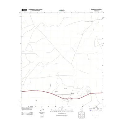
2012 Map of Bakersfield
USGS Topo · Published 2012About this map
Bakersfield and its surrounding ranchlands are situated within a landscape defined by industrial energy extraction and prominent West Texas terrain. The Taylor-Link Oil and Gas Field occupies a significant portion of the central plains, illustrating the continued importance of petroleum production to the local economy. Drainage for the region is provided by the winding course of Tunas Cr, which meanders across a topography marked by distinct elevations such as Squawteat Peak and Hog Peak.
Find a feature on this map
11 named features on this map. Tap any name to fly to it.
Don’t see what you’re looking for? This feature index may not catch every label — zoom into the map to look around manually.
Map Details
Editions of this 2012 Bakersfield Map
This is the sole edition of this map. No revisions or reprints were ever made.
Other maps of this area

1928 · Crane
USGS Topo · 1:125,000

1929 · Independence Draw Quadrangle
USGS Topo · 1:125,000

1954 · Pecos
USGS Topo · 1:250,000

1954 · Fort Stockton
USGS Topo · 1:250,000

1957 · Pecos
USGS Topo · 1:250,000

1958 · Fort Stockton
USGS Topo · 1:250,000

1969 · Bootleg Canyon
USGS Topo · 1:24,000

1969 · Skyscraper Peak
USGS Topo · 1:24,000

1969 · Indian Mesa
USGS Topo · 1:24,000

1969 · Bakersfield
USGS Topo · 1:24,000