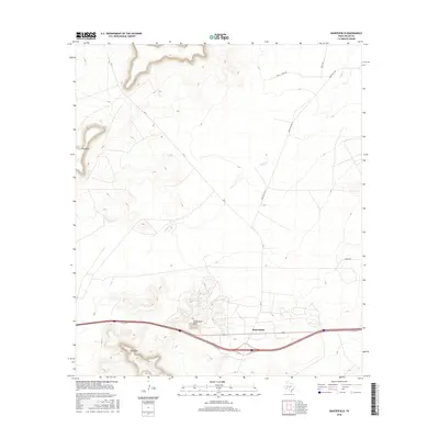
2016 Map of Bakersfield
USGS Topo · Published 2016About this map
Bakersfield sits at the intersection of modern transit and ancient terrain in this Pecos County landscape. The settlement is positioned along the Interstate 10 corridor, where the I10 Svc Rd and FM 11 provide local access across the high desert floor. The topography is dominated by prominent mesas and summits, including the broad Big Mesa in the northwest and the distinctively named Squawteat Peak and Hog Peak rising south of the main road. Drainage for the region is primarily handled by the winding course of Tunas Cr, which cuts through the arid basins between the plateaus. The map also traces several rural routes such as Ranch Rd 1901 and Nevill Rd, illustrating the sparse but vital network of ranch roads that link this remote section of West Texas.
Find a feature on this map
11 named features on this map. Tap any name to fly to it.
Don’t see what you’re looking for? This feature index may not catch every label — zoom into the map to look around manually.
Map Details
Editions of this 2016 Bakersfield Map
This is the sole edition of this map. No revisions or reprints were ever made.
Other maps of this area

1928 · Crane
USGS Topo · 1:125,000

1929 · Independence Draw Quadrangle
USGS Topo · 1:125,000

1954 · Pecos
USGS Topo · 1:250,000

1954 · Fort Stockton
USGS Topo · 1:250,000

1957 · Pecos
USGS Topo · 1:250,000

1958 · Fort Stockton
USGS Topo · 1:250,000

1969 · Bootleg Canyon
USGS Topo · 1:24,000

1969 · Skyscraper Peak
USGS Topo · 1:24,000

1969 · Indian Mesa
USGS Topo · 1:24,000

1969 · Bakersfield
USGS Topo · 1:24,000