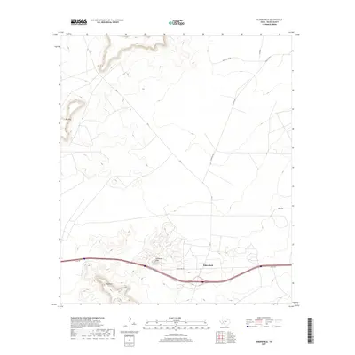
2019 Map of Bakersfield
USGS Topo · Published 2019About this map
Bakersfield sits at the intersection of modern transit and high desert topography in this Pecos County study. The map illustrates a landscape shaped by distinct elevations, notably Big Mesa in the northwest and the prominent southern heights of Squawteat Peak and Hog Peak. The infrastructure of the region is dominated by the corridor of the I10 Svc Rd, which parallels the interstate and connects the small settlement of Bakersfield with secondary routes like State Spur 293. This 2019 survey documents a network of ranching and service roads, such as Ranch Rd 1901 and Ernest Rd, which branch out across the desert floor. The layout of these roads, including the Nevill Cutoff Rd, reveals the continued importance of access to outlying land parcels in the Trans-Pecos region during the early twenty-first century.
Find a feature on this map
11 named features on this map. Tap any name to fly to it.
Don’t see what you’re looking for? This feature index may not catch every label — zoom into the map to look around manually.
Map Details
Editions of this 2019 Bakersfield Map
This is the sole edition of this map. No revisions or reprints were ever made.
Other maps of this area

1928 · Crane
USGS Topo · 1:125,000

1929 · Independence Draw Quadrangle
USGS Topo · 1:125,000

1954 · Pecos
USGS Topo · 1:250,000

1954 · Fort Stockton
USGS Topo · 1:250,000

1957 · Pecos
USGS Topo · 1:250,000

1958 · Fort Stockton
USGS Topo · 1:250,000

1969 · Bootleg Canyon
USGS Topo · 1:24,000

1969 · Skyscraper Peak
USGS Topo · 1:24,000

1969 · Indian Mesa
USGS Topo · 1:24,000

1969 · Bakersfield
USGS Topo · 1:24,000