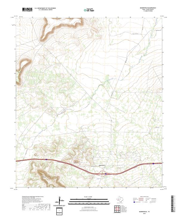
2023 Map of Bakersfield
USGS Topo · Published 2023About this map
Bakersfield sits at the base of the prominent Tunas Peak in this high-desert portion of West Texas. The landscape is defined by its dramatic topography, including the isolated Hog Peak to the southwest and the flat-topped Big Mesa in the northwest. These features rise above the winding path of Tunas Creek, which snakes through the plains and under major local thoroughfares like Ranch Rd 1901. The map reveals the infrastructure of the Permian Basin region, highlighting the network of ranch roads and state-maintained routes such as State Spur 293 and Nevill Rd that provide access to this ranching and energy-producing territory. The intersection of these modern service roads with the old landmarks and peaks offers a clear view of the region's land use and transportation patterns in the early 2020s.
Find a feature on this map
12 named features on this map. Tap any name to fly to it.
Don’t see what you’re looking for? This feature index may not catch every label — zoom into the map to look around manually.
Map Details
Editions of this 2023 Bakersfield Map
This is the sole edition of this map. No revisions or reprints were ever made.
Other maps of this area

1928 · Crane
USGS Topo · 1:125,000

1929 · Independence Draw Quadrangle
USGS Topo · 1:125,000

1954 · Pecos
USGS Topo · 1:250,000

1954 · Fort Stockton
USGS Topo · 1:250,000

1957 · Pecos
USGS Topo · 1:250,000

1958 · Fort Stockton
USGS Topo · 1:250,000

1969 · Bootleg Canyon
USGS Topo · 1:24,000

1969 · Skyscraper Peak
USGS Topo · 1:24,000

1969 · Indian Mesa
USGS Topo · 1:24,000

1969 · Bakersfield
USGS Topo · 1:24,000