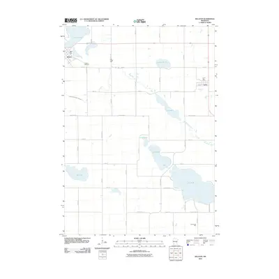
2010 Map of Balaton
USGS Topo · Published 2010About this map
Balaton and Garvin anchor this section of Lyon County, where the agricultural landscape is defined by a dense concentration of glacial lakes and drainage systems. The town of Balaton sits on the shores of Lake Yankton, supported by the Yankton Lake Dam, while further east, the small settlement of Garvin serves the surrounding farmsteads. The southern portion of the map is dominated by the large expanse of Lake Sarah and its associated Sarah Lake Dam, a significant local water body that shapes the region's recreation and hydrology.
Find a feature on this map
42 named features on this map. Tap any name to fly to it.
Don’t see what you’re looking for? This feature index may not catch every label — zoom into the map to look around manually.
Map Details
Editions of this 2010 Balaton Map
This is the sole edition of this map. No revisions or reprints were ever made.
Other maps of this area

1953 · New Ulm
USGS Topo · 1:250,000

1957 · New Ulm
USGS Topo · 1:250,000

1958 · New Ulm
USGS Topo · 1:250,000

1962 · Amiret
USGS Topo · 1:24,000

1963 · Russell
USGS Topo · 1:24,000

1963 · Marshall SE
USGS Topo · 1:24,000

1967 · New Ulm
USGS Topo · 1:250,000

1967 · Balaton
USGS Topo · 1:24,000
1967 · Balaton SW
USGS Topo · 1:24,000

1967 · Hadley
USGS Topo · 1:24,000