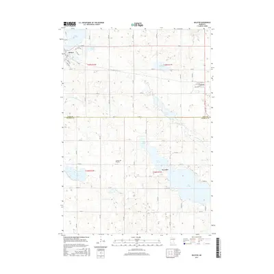
2016 Map of Balaton
USGS Topo · Published 2016About this map
The Balaton and Garvin settlements anchor this portion of southwestern Minnesota, situated upon the glacial uplands of the Coteau des Prairies. This plateau landscape is defined by a dense network of prairie pothole lakes and wetlands, ranging from the expansive Lake Sarah and Lake Maria to the smaller Iron Lake and Spink Lake. The map reveals the early headwaters of the Des Moines River as it begins its journey across the plains, alongside a grid of rural section roads like Co Hwy 12 and Co Rd 100. The town of Balaton is positioned prominently between Lake Yankton and the northern reaches of the Coteau, reflecting a community closely tied to its water bodies. This 2016 survey documents the enduring agricultural and hydraulic character of the Lyon and Murray county line, where features like County Ditch Number Forty-eight illustrate long-standing land management efforts.
Find a feature on this map
49 named features on this map. Tap any name to fly to it.
Don’t see what you’re looking for? This feature index may not catch every label — zoom into the map to look around manually.
Map Details
Editions of this 2016 Balaton Map
This is the sole edition of this map. No revisions or reprints were ever made.
Other maps of this area

1953 · New Ulm
USGS Topo · 1:250,000

1957 · New Ulm
USGS Topo · 1:250,000

1958 · New Ulm
USGS Topo · 1:250,000

1962 · Amiret
USGS Topo · 1:24,000

1963 · Russell
USGS Topo · 1:24,000

1963 · Marshall SE
USGS Topo · 1:24,000

1967 · New Ulm
USGS Topo · 1:250,000

1967 · Balaton
USGS Topo · 1:24,000
1967 · Balaton SW
USGS Topo · 1:24,000

1967 · Hadley
USGS Topo · 1:24,000