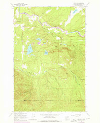
1959 Map of Bald Hill
USGS Topo · Published 1975About this map
The Nisqually River carves the northern border of this terrain, where Pierce and Thurston counties meet amidst a landscape of glacial lakes and shifting river systems. Local life centers around the Lackamas Sch and the surrounding timbered uplands, punctuated by significant water bodies such as Clear Lake and Kreger Lake. The 1973 photorevision updates highlight changes in infrastructure, particularly along Bald Hill Road and the Tanwax Extension Road, reflecting the area's steady evolution from a rural outpost toward more modern connectivity.
Find a feature on this map
30 named features on this map. Tap any name to fly to it.
Don’t see what you’re looking for? This feature index may not catch every label — zoom into the map to look around manually.
Map Details
Editions of this 1959 Bald Hill Map
2 editions found
Other maps of this area

1916 · Chehalis
USGS Topo · 1:125,000

1937 · Eatonville
USGS Topo · 1:125,000

1941 · Tanwax Lake
USGS Topo · 1:62,500

1943 · Willapa
USGS Topo · 1:62,500

1944 · Yelm
USGS Topo · 1:62,500

1944 · Ohop Valley
USGS Topo · 1:62,500

1949 · Ohop Valley
USGS Topo · 1:62,500

1949 · Yelm
USGS Topo · 1:62,500

1953 · Hoquiam
USGS Topo · 1:250,000

1954 · Onalaska
USGS Topo · 1:62,500