
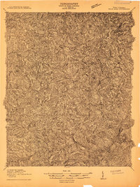
1910 Map of Bald Knob
USGS Topo · Published 1910About this map
The C and O railway lines push through the deep drainage of the Coal River on this 1910 survey, serving a landscape defined by industrial expansion and isolated mountain gaps. High ridges such as Bald Knob Mountain and Cherrypond Mountain dominate the terrain, creating natural boundaries for the districts of Washington, Cook, and Sherman.
Find a feature on this map
112 named features on this map. Tap any name to fly to it.
Don’t see what you’re looking for? This feature index may not catch every label — zoom into the map to look around manually.
Map Details
Editions of this 1910 Bald Knob Map
2 editions found
Other maps of this area

1891 · Oceana
USGS Topo · 1:125,000

1891 · Raleigh
USGS Topo · 1:125,000

1893 · Oceana
USGS Topo · 1:125,000

1897 · Kanawha Falls
USGS Topo · 1:125,000

1897 · Raleigh
USGS Topo · 1:125,000

1898 · Oceana
USGS Topo · 1:125,000

1899 · Charleston
USGS Topo · 1:125,000

1900 · Kanawha Falls
USGS Topo · 1:125,000

1901 · Kanawha Falls
USGS Topo · 1:125,000

1902 · Raleigh
USGS Topo · 1:125,000